 The Trails Council has a new map!
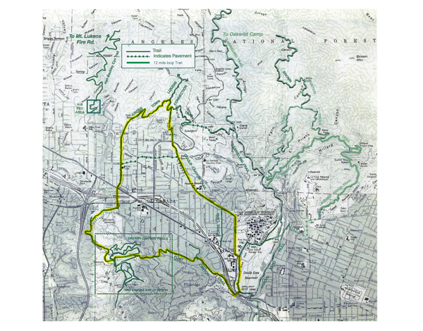
Full color map including Cherry Canyon trails and the full City Loop is now available at Flintridge Bookstore, LCF Chamber of Commerce, and the Lanterman House for $2 donation.
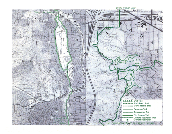
The older La Cañada Flintridge Trails Council is available here as a 2 page Adobe Acrobat (PDF) file. Click on the link below to download it. These maps indicate the trail connections with our bordering Angeles National Forest and with the communities of Altadena, Pasadena, and South Pasadena.
If you would like further information on how to receive this printed version of this map, and how you can support us, please go here.
Trail Map 2 Pages La Cañada Flintridge Trails Map, October, 2011


